Skip to content
Brentford Knot

The History of Brentford

A Timeline of Brentford History

  • Early Days
    • To 793
    • 802-1215
    • 1216-1455
    • 1461-1600
  • 17th Century
    • 1603-1623
    • 1625-1659
    • 1660-1685
    • 1688-1702
  • 18th Century
    • 1702-1714
    • 1714-1760
    • 1760-1798
  • 19th Century
    • 1800-1815
    • 1820-1835
    • 1837-1856
    • 1857-1875
    • 1876-1901
  • 20th Century
    • 1901-1910
    • 1910-1936
    • 1936-1947
    • 1949-1963
    • 1964-1999
  • Resources
    • Books
    • Listed Buildings
      • Grade II listed buildings
      • Grade I listed buildings
      • Locally listed buildings
    • Links
    • About Us
  • Connections
    • Literature
    • TV and Film
    • Adverts
    • People

Category: Places

Boar's Head Yard
Places

Boar’s Head Yard

Built before 1635 as a yard, now of mixed use.

In Thames Policy Area.

History

Ancient yard between what is now Sami’s Spice & Magpie & Crown. Continue reading “Boar’s Head Yard”

Unknown's avatarKathOctober 28, 2013Leave a comment
Bradbury's Yard
Industry, Places

Bradbury’s Warehouse

Bradbury’s Wholesale Grocer’s warehouses and yard
behind 107-111 High Street

Constructed as warehouses 1850-1870 and now derelict.

In Thames Policy Area.

History

Accessed from what is now Brent Way. Continue reading “Bradbury’s Warehouse”

Unknown's avatarKathOctober 27, 2013Leave a comment
107-111 High Street
Places

107-111 High Street

Constructed between 1910-30 for use as Bradbury’s shop, now several shops. In Thames Policy Area. History First shop in this group fills in what was the alley through to Bradbury’s yard and down to the wharf on the canal. Bradbury’s were wholesale grocers founded c1840. By the 1890s they occupied 108 and 109 and ran a fleet of 20 horse drawn vans delivering to shops … Continue reading 107-111 High Street

Unknown's avatarKathOctober 26, 2013Leave a comment
Post Office, 102-6 High Street
Places

102-6 High Street

Originally built as shops, now includes post office. In Thames Policy Area History Buildings form a group with decoration above. Was clearly a building of some importance due to decoration. Further Information As of September 2013 Ballymore states this building will be retained and incorporated into the new development. [mapsmarker marker=”38″] Continue reading 102-6 High Street

Unknown's avatarKathOctober 25, 2013Leave a comment
NatWest Bank
Places

NatWest Bank

100-101 High Street
TW8 8AY

Built as a bank in 1929 and so remains.

In Thames Policy Area Continue reading “NatWest Bank”

Unknown's avatarKathOctober 24, 2013Leave a comment
Bradshaw Yard
Places, Waterways

Bradshaw’s Yard

Bradshaw’s Yard / Workhouse Dock Built in 1800s as docks and remain so. In Grand Union & Boston Manor Conservation Area and Thames Policy Area. History Early wharfs along this stretch on Moses Glover map (1645) were called Ye Pye Wharf, Ye Wolfe Wharf and Ye Whele Wharf. Workhouse Dock is marked on Boston Manor map c.1800. Slipway of particular interest. [mapsmarker marker=”36″] Continue reading Bradshaw’s Yard

Unknown's avatarKathOctober 23, 2013Leave a comment
Plough Yard
Places

Plough Yard

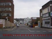
Originally a yard, now part of Brent Way.

In Thames Policy Area

History

Ancient yard, including two possible 19th century buildings
Continue reading “Plough Yard”

Unknown's avatarKathOctober 22, 2013Leave a comment
Catherine Wheel Road
Places

Catherine Wheel Road

Originally a yard, now of mixed use.

In Thames Policy Area. Continue reading “Catherine Wheel Road”

Unknown's avatarKathOctober 21, 20131 Comment
Dr Johnson's Island
Places, Waterways

Dr Johnson’s Island

Originally used as a dock, this is now an artists studio and boatyard.

In Grand Union & Boston Manor Conservation Area; Thames Policy Area.

History

At the confluence of the Rivers Thames and Brent and the Grand Union Canal, the area was important historically for the barges that had carried goods to and from Birmingham. Continue reading “Dr Johnson’s Island”

Unknown's avatarKathOctober 20, 2013Leave a comment
80 High Street
Places

80 High Street

Built in 18th century as residential, now offices.

Grade II Statutory Listed

In Grand Union Canal & Boston Manor Conservation Area and Thames Policy Area.

Continue reading “80 High Street”

Unknown's avatarKathOctober 19, 2013Leave a comment

Posts navigation

Older posts
Newer posts

Recent Comments

Unknown's avatarLondon's Wonder… on Brook Road South – The B…
Brentford Travel Gui… on The New Inn
Frances Jose Darby's avatarFrances Jose Darby on Brewery Tap
Celia Cotton's avatarCelia Cotton on 1760-1798
Robert Kingham's avatarRobert Kingham on Brook Road South – Marke…

This slideshow requires JavaScript.

Categories

  • amenity
  • Business
  • Education
  • Events
  • House
  • Industry
  • People
  • Places
  • public houses
  • Resources
  • Waterways
  • Welcome

Tags

#50 1815 1820 1841 1850 1853 1865 1869 1872 1877 1883 1887 1888 1889 1891 1893 1894 1895 1897 1898 1904 1908 1911 1921 1935 1939 1963 Albany Road art deco At Risk bank Bradbury's Braemar Road Brentford Chamber of Commerce Brentford FC Brentford Local Board Brentford Market Brentford Urban District Council brewery bridge Brook House Brook Road Brook Road South canal church Clifden Road co-author: Catherine McCallum coal cobbles cottages dairy dock Ealing Road football Fuller Fuller's Grade II Griffin Park High Street Lateward Road locally listed Market House New Road Nowell Parr residence residences residential shops stables the Butts wall Wallis Gilbert and partners warehouse Wilson & Kyle yard

Please do credit us if you quote us / use our photos, which you are welcome to do.

If you have old photos or articles, or if you have memories of Brentford we would like to hear from you. Please do add extra information to posts.

Please post your questions about local history to Local Studies at Hounslow (not affiliated with this website).


My Tweets
Blog at WordPress.com.
The History of Brentford
Blog at WordPress.com.
Privacy & Cookies: This site uses cookies. By continuing to use this website, you agree to their use.
To find out more, including how to control cookies, see here: Cookie Policy
  • Subscribe Subscribed
    • The History of Brentford
    • Join 25 other subscribers
    • Already have a WordPress.com account? Log in now.
    • The History of Brentford
    • Subscribe Subscribed
    • Sign up
    • Log in
    • Report this content
    • View site in Reader
    • Manage subscriptions
    • Collapse this bar
 

Loading Comments...