


Brook Road South – Growth of Housing
The first houses to be built after the land sale in 1872 were on the west side running north from Albany Road. They were numbered consecutively with numbers 8, 9, 10 and 11 north of Grosvenor Road which ran down hill to towards the recreation ground. They were called Grosvenor Terrace and are now numbers 14, 16, 18 and 20 Brook Road South.
The builder, Henry Spicer lived at the Lord Nelson PH in Enfield Road was brought to account in 1883 for allowing these 4 houses to be occupied without giving notice to the Sanitary Authority. Continue reading “Brook Road South – Growth of Housing”
Brook Road South – Brook House

In 1872 there was a major sale of the cultivated land between Albany Road and the railway.
The piece of land that is now the south side of the football ground was bought for £580 by John Carpenter who lived at Brook House on the north west corner. This was Lot 19 and described as ‘enclosed on all sides nearly with substantial fruit walls, well stocked with fine standard and other fruit trees, also four division and two cross walls all well clothed with choice fruit trees, a packing shed and a well of water’. Brook House looks to have been quite a large house with a formal garden but there don’t seem to be any pictures of it. (Unless any readers can provide one!)
Mr Carpenter had been born in Sussex in 1814 and by the time of the 1841 census had a business as an ‘oilman’ at 52, High Street. He was married with 5 children. This business was described as ‘oil and colour trade’ by 1861 and he was also shown in directories as a ‘rag and general merchant’. Continue reading “Brook Road South – Brook House”
Brook Road South – Market Gardening
In 1837, a few months after Victoria became Queen, a piece of land between Brook Lane and Drum Lane (now Ealing Road) was for sale. It was described as 4 acres of partly walled Market Garden Ground and it contained ‘Three Respectable, residences, a cottage and numerous outbuildings’.
The map with the notice of sale shows that the buildings were near the present site of the Griffin. There’s a bend in Brook Lane to the left which is still there and the brook runs as an open stream along the west side of the road. Continue reading “Brook Road South – Market Gardening”
1840 – The Marriage of Queen Victoria
Queen Victoria and Prince Albert journeyed through Brentford for their honeymoon. Brentford as it looked on that occasion. Continue reading 1840 – The Marriage of Queen Victoria
Brook Road South – The Brook
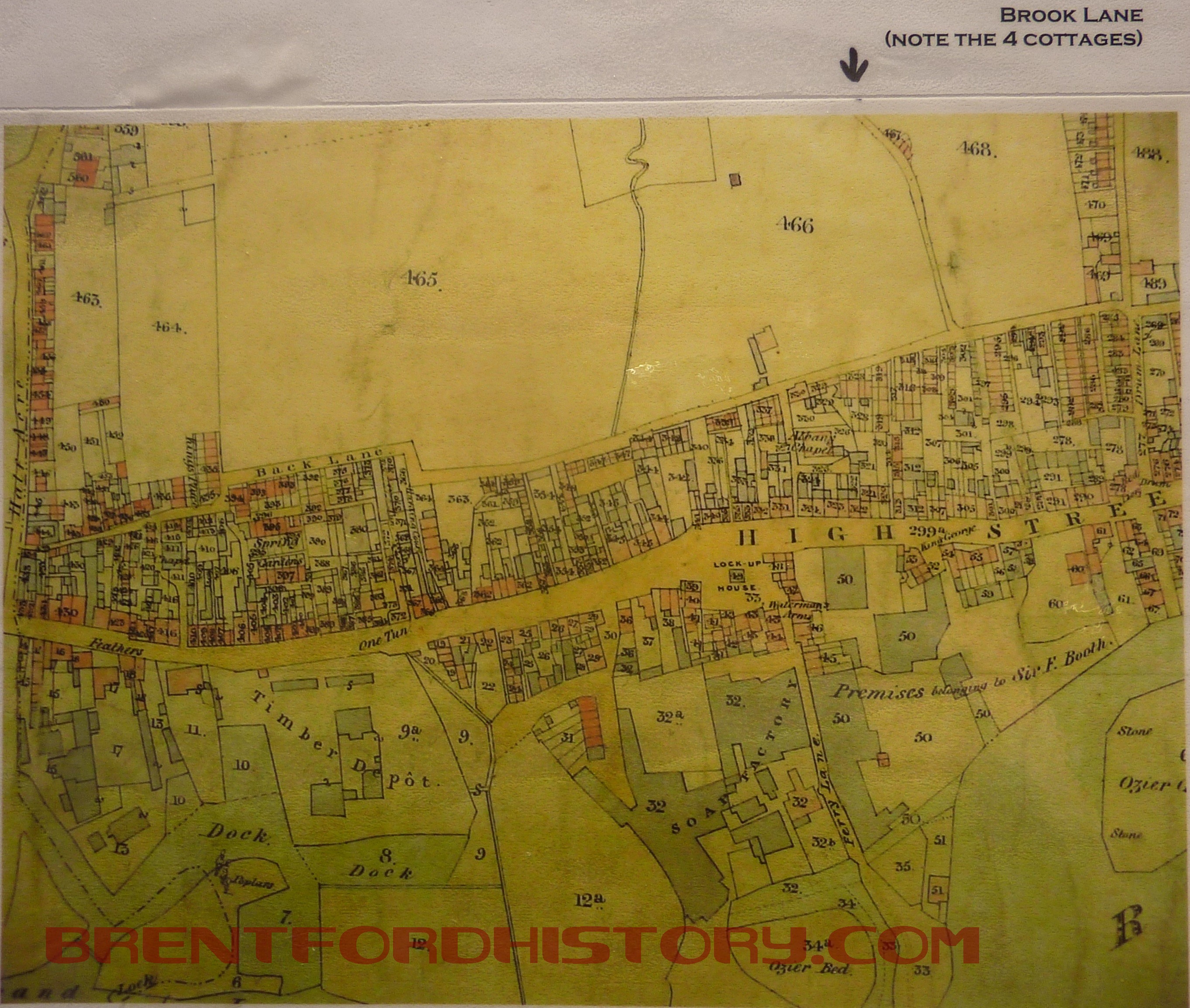
The Tithe Map of Brentford in 1841 shows that the area of the town west of Drum Lane (now Ealing Road) was tightly packed buildings between the High Street and Albany Road with open ground beyond. Running north to south is a blue line marking the route of the brook. Parallel with the water course is a narrow road and at a sharp bend there are four cottages later called Brook Terrace. Continue reading “Brook Road South – The Brook”
Welcome
Welcome to this site which is currently in development. This site has a Brentford timeline; a history that runs from prehistoric times to now, with all the key events in Brentford history, an index of events that was created by one of Brentford’s finest amateur historians. From this timeline we will link to existing articles on the internet that are about Brentford’s history as well … Continue reading Welcome
